
News
Sheridan works with Army Corps of Engineers to restore fish habitat and riparian ecosystem
In 1963, construction of the Sheridan flood control project was completed under the authority of the Flood Control Act of 1950, according to the US Army Corps of Engineers.
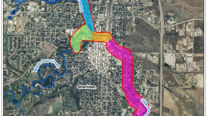
The 1963 flood control project was designed to protect the city from Goose Creek and Little Goose Creek flood discharges, consisting of levees, drainage structures, concrete chutes and drop structures, and channel alterations. Although the flood control project is operating as intended, the ecosystem in the vicinity of the project has become severely degraded, calling for the City of Sheridan to partner with the Army Corps of Engineers to move forward with an extensive ecosystem restoration project.
Designated the 1135 Ecosystem Restoration Project, the total cost of phase one and two is an estimated $7.7 million. Sheridan’s portion of that cost is $1.4 million worth of land, easements, ROW, in-kind work and $550,000 in cash.
Toward the end of the summer season, the water increases in temperature due to the shallow flow, according to Sheridan city councilman Thayer Shafer. The resulting flow decrease has caused the surrounding ecosystem to degrade. According to Shafer, the ecosystem restoration project will increase the depth of water through the flow and add other improvements, increasing fish habitat and riparian habitat both in the aquatic and terrestrial areas.
Phase 1 of the project will begin soon with bids expected to be announced in the near future to begin the installation of a boulder cluster, j-hooks and riffles (a shallow landform in a flowing channel) in the Sheltered Acres Park area to the concrete flood control channel.
The plan also includes recreation features that complement the ecosystem restoration components, including adding new trails, benches and educational interpretive signage. The project was designed to be compatible with maintaining the existing flood protection that the channel and levee system provides, and no project features will increase flood risks for the city.

Janice J Gosch
September 12, 2020 at 12:59 pm
All that money and higher taxes. Yah all the trails, benches and extras..all the more for vandals to destroy. Hope there are security cameras and surveillance included.