News
Deadman Fire Update
Northern Rockies Team 3, Incident Commander Mike Behrens with the Bureau of Land Management Montana-Dakotas State Office reports that fire managers assessed the fires yesterday, and containment numbers have risen.
Key message
According to the report, in locations where the fires are contained, there is a cold black line around the edges and a very low probability that the fire will cross fire lines. They will continue to assess the fires and these numbers will likely increase.
On July 15, fire managers took a reconnaissance flight and confirmed the Hackley and Prairie fires had burned together, reaching an estimated combined 6,540 acres. This fire will now be referred to as the Prairie Fire.
Current status
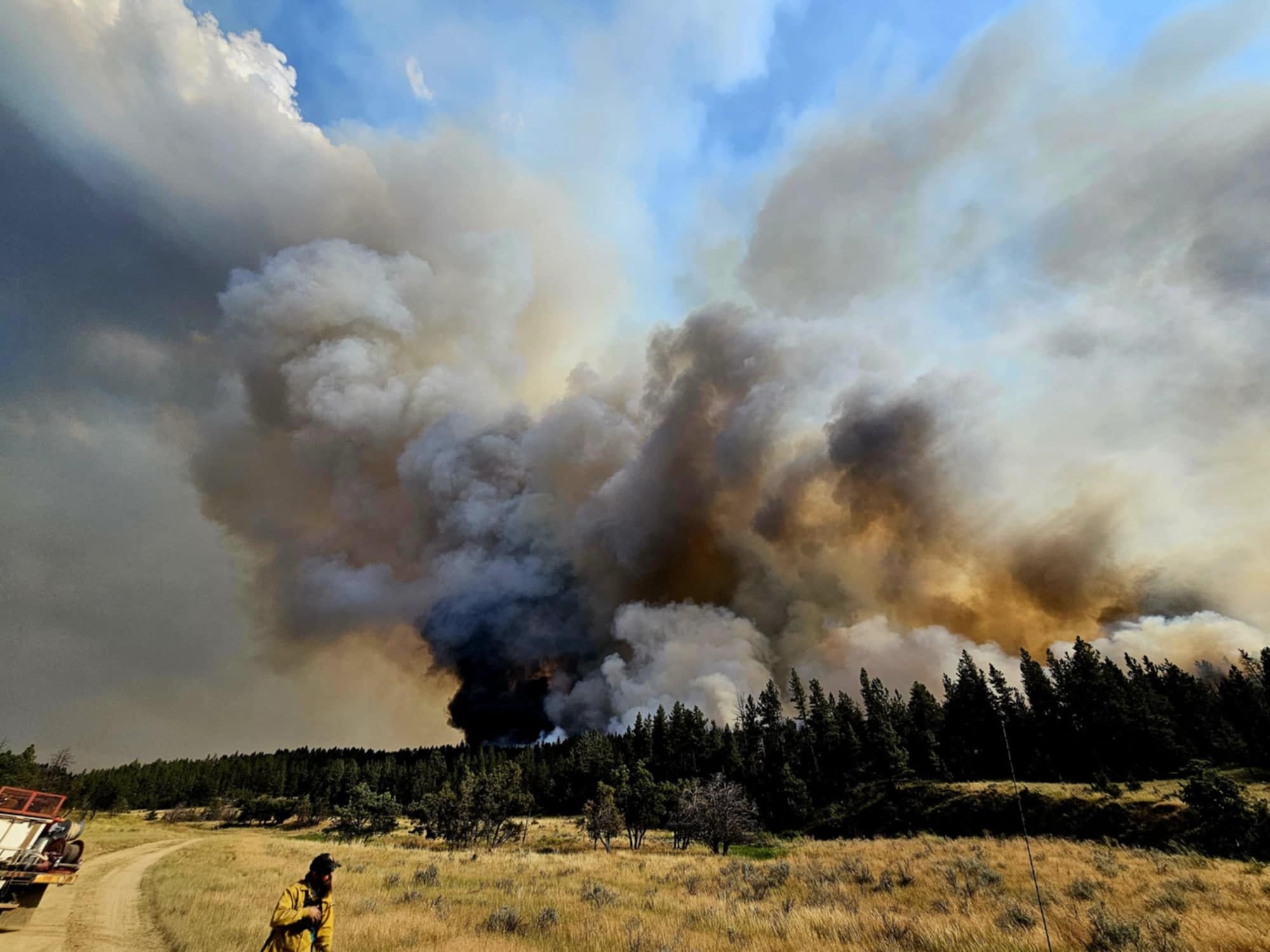
As of July 16, the most active fire is McGhee, pushing east and north towards Birney on Sunday night. On Monday, crews conducted successful burnouts along the north side and continued strengthening those lines on Tuesday.
South of Pyramid Butte on the east, the fire made a big push towards Hanging Woman Creek Monday afternoon. A grader improved lines along the eastern side while crews did burnout operations, supported by Very Large Air Tankers (VLATs) with retardant drops. An overnight shift worked to hold and improve the lines. Fire managers are assessing and implementing a strategy to tie together the eastern and southern lines.
The Deadman Fire remains active on the west side, backing towards the Tongue River. While the terrain makes it difficult to access, crews will look for opportunities to use an Unmanned Aerial System (drone) to conduct burnout operations to bring the fire down to and hold it on the river.
On the Four Mile Fire, firefighters are cooling the remaining hot spots and patrolling the edges. The Prairie Fire is showing little heat and is being monitored.
Weather and behavior
The weather remains hot and dry for the foreseeable future. Another cold front today brings slightly cooler temperatures and higher humidity. However, as this front passes, a ridge of high pressure will build, bringing hotter temperatures and lower humidity.
Closures and special messages
In Big Horn County, an evacuation warning is in place for residents from the intersection of Dale Creek Road and East Fork Canyon Road, east to the county line; from the intersection of Dale Creek Road and East Fork Canyon Road south to the intersection of Birney Road and Highway 314; from the intersection of Highway 314 and Birney Road east to the county line.
In Rosebud County, an evacuation warning is in place for residents along the Tongue River Road from the Tongue River Bridge at Wall Creek to the southern Rosebud County line. Specific closure information and maps on the Big Horn County Facebook Page and the Rosebud County Disaster And Emergency Services Page.