News
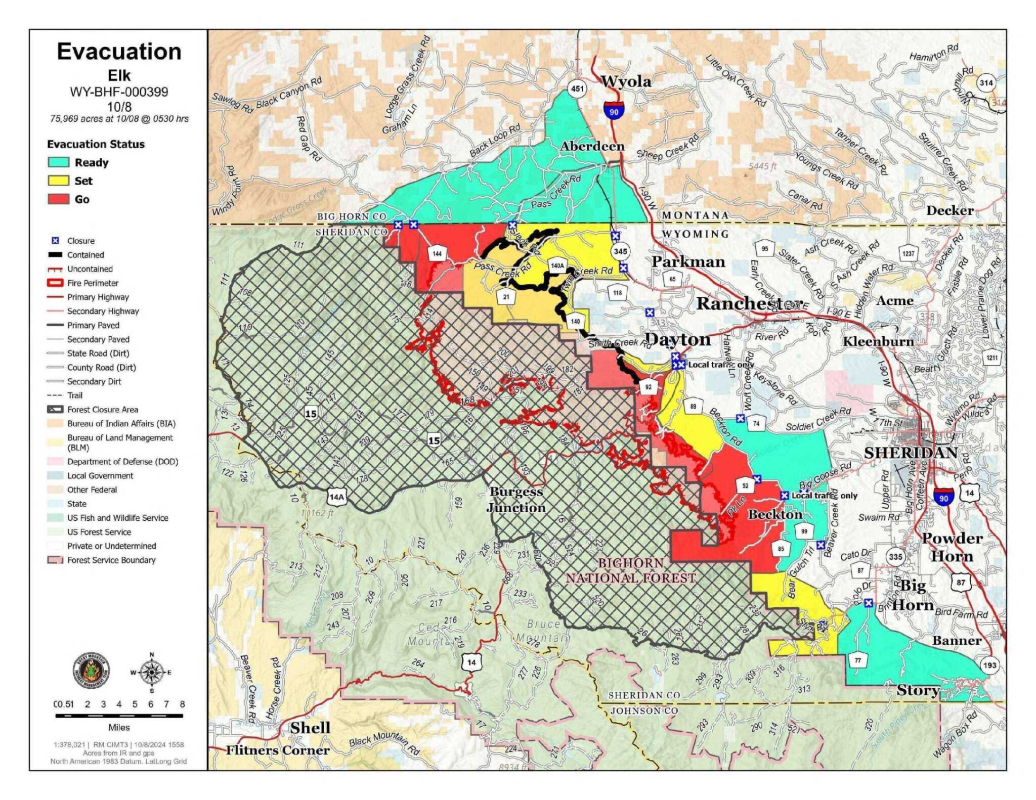
No Changes to Evacuation Map

There are no changes to the Evacuation Map as of 11:00 am Thursday.
The Sheridan County Sheriff’s Office and Incident Command are working closely together to reevaluate the area at Pass Creek Road from Hwy 345 west to Slack Road and north to the Montana state line. This includes the residences along Slack Road. South along East Pass Creek Road from its intersection with Pass Creek Rd to the Forest Service boundary continuing east to include the length of Twin Creek Road to move from a Set to a Ready. However as of Thursday. there are no changes to their Set status.
As well, officials continue to monitor fire behavior in the rest of the evacuation area to assess the need to change or add to the map.
Conditions are changing rapidly. It is encouraged everyone to monitor the Sheridan County Facebook page and the Sheridan County website for the most up-to-date information.
- Sheridan County Emergency Management
- Phone: 307-752-2174
- Sheridan County Web Site: www.sheridancountywy.gov
- Follow us on Facebook at https://www.facebook.com/SheridanCountyGovernment for live updates.

